| Place of Origin: | Made in china |
|---|---|
| Brand Name: | No brand or OEM |
| Certification: | No Certificate |
| Model Number: | G10 |
| Channel: | 220 Channels | Screen Size: | 3.5inch |
|---|---|---|---|
| GPS: | L1 C/A, L2C, L2E, L5 | GLONASS: | L1 C/A, L1P, L2 C/A, L2P,L3 |
| SBAS: | L1 C/A, L5 | GALILEO: | E1, E5A, E5B |
| Initialization Time: | Typically<10s | Real Time Kinematics(RTK): | Horizontal: 8mm + 0.8ppm RMS;Vercial:15mm + 1ppm RMS |
| Code Differential Positioning: | Horizontal: 0.25mm + 1ppm RMS; Vertical: 0.45mm + 1ppm RMS | Compass: | B1(QPSK),BI-MBOC(6,1,1/11),B1-2(QPSK),B2(QPSK),B2-BOC(10,5),B3 (QPSK), B3BOC(15,2,5), I5(QPSK) |
| Frequency Range: | 410~470MHz | Size: | Φ14cm X 14.4cm (H) |
| Waterproof/Dustproof: | IP67 | Power: | Lithium Battery Working Time In Static(GPS+GLONASS) :12hours |
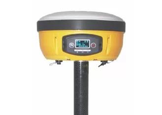
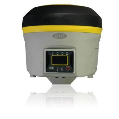
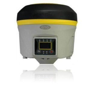
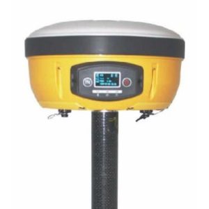
G10 220 channels GNSS Receiver with trimble board BD970
Specifications
RECEIVER
- Channels :220 GNSS
- Satellites Tracked
GPS: Simultaneous L1C/A, L2C, L2E, L5
GLONASS: Simultaneous Ll C/A, LIP, L2 C/A, L2P,L3
SBAS: Simultaneous LI C/A, L5
GALILEO Simultaneous El, E5A, E5B(reserved)
COMPASS: Bl (QPSK), Bl- MBOC (6,1, 1/11), BI-2 (QPSK), B2 (QPSK), B2-BOC (10,5), B3 (QPSK),B3BOC(15,2,5),l5(QPSK)
QZSS: Ll C/A, Ll SAIF, L2C, L5
- Position Rate: Up to 50 Hz
- Signal Reacquisition: < 1 sec
- RTK Signal Initialization: Typically < 10 s
- Hot Start: Typically < 15 s
- Initialization Reliability: > 99.9 %
- Internal Memory: 4 GB (Over 45 days of raw static data storage with recording sample every 1 second)
- Micro SD Card: Expansion slot with 4 GB internal memory (32 GB optional)
POSITIONING
- HIGH PRECISION STATIC SURVEYING (Lon Time Observations) Horizontal: 2.5 mm + 0.1 ppm RMS
Vertical: 3.5 mm + 0.4 ppm RMS
- FAST STATIC
Horizontal: 3 mm + 0.5 ppm RMS
Vertical: 5 mm + 0.5 ppm RMS
- CODE DIFFERENTIAL POSITIONING Horizontal: 0.25 mm + 1 ppm RMS
Vertical: 0.45 mm + 1ppm RMS
- SBARS POSITIONING(Typical) Horizontal: 0.5 m RMS²
Vertical: 0.8 RMS²
- REAL TIME KINEMATIC(<30km)-NETWORK SURVEYING³ Fixed RTK Horizontal: 8mm +0.8ppm RMS
Fixed RTK Vertical: 15mm + 1ppm RMS
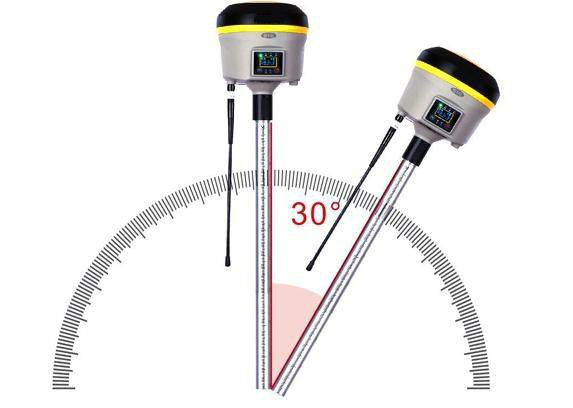
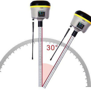
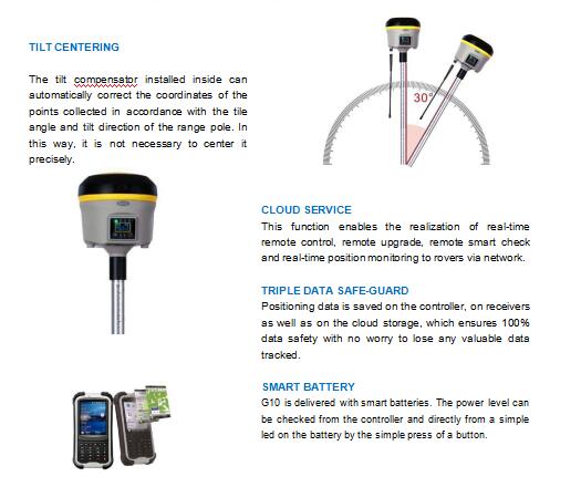
- TILTED POSITINING(2m POLE) 10°inclination 20 mm RMS
20°inclination 30 mm RMS 30°inclination 50 mm RMS
COMMUNICATION
- Connectors I/O
- 7-pins Lemo and 5-pins Lemo Interfaces. Multifunction cable with USB interfaces for PC connection.
- Bluetooth device: 2.4 GHz class Il
- Wi-Fi: IEEE 802.11 b/g/n
- Web UI: To upgrade the software, manage the status and settings, data download, etc. via smart phone, tablet or other internet enabled
electronic device
- Navigation outputs: ASCII (NMEA-0183) GSV, AVR, RMC, HDT, VGK, VHD, ROT, GGK, GSA, ZDA, VTG, GST, PJT, PJK, BPQ, Reference
outputs: CMR, CMR+, sCMRx, RTCM2.1, RTCM2.3 RTCM3.O, RTCM3.1,GRS, GBS.
INTEGRATED GNSS ANTENNA
- High accuracy four constellation micro-strip antenna, zero-phase center with internal multipath suppressive board.
INTERNAL RADIO
- Frequency Range: 410-470MHz
- Channel Spacing: 12.5KHz/25 KHz
- Rx/Tx Power:2W
- Maximum Range: 3-4 Km in urban environment, up to 10 Km with optimal conditions.
- Protocol: Transparent EOT/EOC/FST, SATEL. South, TRIMTALX 11/11e, TRIMMARK 3, TRIMTALK 450S
WIRELESS MODULE
- Band: GSM/GPRS/EDGE: 850/900/1800/1900 MHz
WCDMA/HSDPA: 850/1900/2100 MHz
- Output Power: GSM850, EGSM900: 33 dBm(2W)
GSM1800, PCS1900: 30 dBm(1W), WCDMA: 24 dBm
POWER SUPPLY
- Battery: Rechargeable and replaceable 11.1 V -3400 -37.74Wh intelligent lithium battery
- Voltage: 9 to 22 V DC external power input
- Working Time in Static ( GPS+GLONASS):12hours
- Working Time in GSM RTK( GPS+GLONASS):6.5hours
- Charge Time(2batteries):Typically 4hours
- Power Consumption:<6w
PHYSICAL SPECIFICATION
- Size: Φ14cm×14.4cm H
- Operating Temperature: -40℃to 65℃ (-22℉to149℉)
- Storage Temperature: -40℃to 85℃ (-40℉to185℉)
- Operating Temperature with UHF UHF Radio: -30℃to 50℃
- Waterproof/ Dustproof: IP67
s Shock Resistance: Designed to endure to a 2 m pole drop on
concrete floor with no damage. Designed to endure a 1 m free drop on
hardwood floor with no damage
s Vibration : Vibration resistan

